Browsing: GPS

Cruising Life
By

What To Do If You Lose Your GPS Signal

What should you do if you’re cruising and you lose your GPS signal? Never happen? Well, yes it will. Not often, but it happens on new boats, old boats, coastal boats and offshore boats. But not to panic. Here’s some great advice from Simrad about what to do next: What happens to my boat if I stop receiving satellite positioning data? In the very rare event that the satellites of the GPS global positioning system fail, are taken offline or are blocked, you’ll still be absolutely fine. Here are five useful tips covering what to do if you lose live…

Cruising Life
By

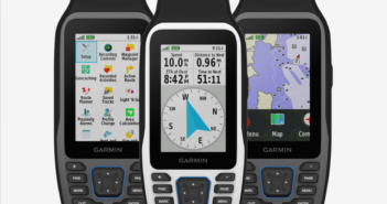
Garmin Launches New Handheld GPS, Radar

Garmin is making a lot of news at the big Fort Lauderdale show, with the introduction of a new series of marine handheld GPS models, as well as two new solid-state dome radars. The handheld GPSMAP 79 has an all-new appearance with a modern display to help you navigate safely and enjoy your time on the water. It has a rugged, floating design with a suite of easy-to-use nav tools that fit in the palm of your hand. The new Garmin has a larger, optically-bonded display and a scratch-resistant glass lens that prevents fogging, improves contrast and enhances clarity, even…

Cruising Life
By

Is Our GPS System Too Vulnerable?

What would happen if your GPS went down? I don’t mean just the GPS on the chartplotter on your boat, or on your smartphone, or on your tablet, or even on your fitness watch. I mean the entire system. What would happen? Total chaos. Much of our infrastructure and our national defense is based on GPS. Forget about autonomous trucks on the interstate, or getting your next delivery from Amazon. GPS has become an unseen, but invaluable, part of our daily life. The problem is, at least according to this thought-provoking story in The New York Times, it’s too vulnerable.…

Cruising Life
By

U.S. Maritime Administration Warns of GPS Signal Loss

Here’s another warning about possible GPS signal problems from the U.S. Maritime Administration, part of the Department of Transportation. It said it has received reports recently of lost or inaccurate GPS signals in various parts of the world. To be safe in areas where GPS is potentially unreliable, mariners are urged to use redundant nav systems. The Maritime Administration just issued its warning, called “Various GPS Interference.” It says, “Multiple instances of significant GPS interference have been reported worldwide in the maritime domain. This interference is resulting in lost or inaccurate GPS signals affecting bridge navigation, GPS-based timing, and communications…

Cruising Life
By

New FCC Decision Could Hurt GPS Accuracy

Despite initial opposition from the Coast Guard, the Pentagon, the Departments of Homeland Security, Transportation, Commerce and Interior, plus NASA and the FAA, the Federal Communications Commission has given a private equity firm permission to run a 5G wireless network that could harm the reliability of GPS signals. BoatUS, part of a new group called the Keep GPS Working Coalition, also opposes the ruling. “With this decision, the FCC is permitting one private company to upend the entire reliability of GPS,” said David Kennedy, the BoatUS manager of government affairs. “It’s unfathomable that the lone federal caretaker of our national…

On Watch with Peter Janssen
By

Why Are These Ships Running in Circles?

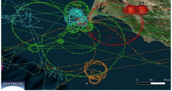
We all know that AIS (Automatic Identification System) is a major advance in boat navigation and safety. It shows the track of vessels underway throughout the world, and is used by thousands of commercial and recreational vessels. It adds a new level of safety, and displays the name and location of boats near you, even before they can see you. When it works. There is now reason to think that some vessels’ AIS systems have been hacked. The mystery is why, and who did it. The problem is that AIS tracks showed about a dozen ships traveling in circles near…

Cruising Life
By

Dept. of Homeland Security: Your Old GPS Might Not Work After April 6

If you’re cruising anywhere on or after April 6, you might want to check your GPS, particularly if it’s an older one. It might not be working. The problem is what is called a Global Positioning System Week Rollover Event on April 6. If your GPS is not designed to handle the rollover, it might revert to an earlier year, in which case it would not be able to calculate your position accurately. This situation should not appear with relatively new GPS devices, but it could appear in older models. The issue is severe enough that the Department of Homeland…

Cruising Life
By

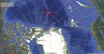
Magnetic North Pole Moving 31 Miles a Year. Scientists Rush To Update Charts

The magnetic North Pole is moving so fast that scientists are issuing an emergency update to maps used by electronic navigation systems. Magnetic north has crept from the coast of northern Canada a century ago to the middle of the Arctic Ocean now, and it’s moving at what scientists say is “an unusually high speed” of about 31 miles a year. As a result they are making an unprecedented early update of the World Magnetic Model, which fixes the pole and is responsible for the accuracy of GPS and all modern navigation on everything from nuclear submarines to your latest…

Electronics
By

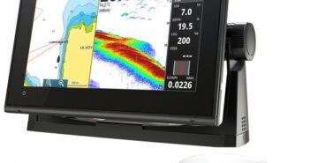
Brand-New Simrad Radar, GPS, Fishfinder Package for Smaller Cruising Boats

Simrad has just announced its new GO9 XSE 4G radar bundle with the company’s TotalScan, fishfinder and chartplotter, all in a user-friendly, multi-touch 9” display for smaller cruising boats. The new package has plug-and-play support for Simrad Broadband Radar and halo Pulse Compression radar systems. The bright widescreen has built-in GPS, GoFree Wi-Fi and standard NMEA 2000 capability. You can connect it to smartphones and tablets, control the sound system, monitor engine data and choose from an array of built-in sonar technology to catch the fish you want. The FMCW radar has Simrad’s Broadband 3G radar but with more features,…

Electronics
By

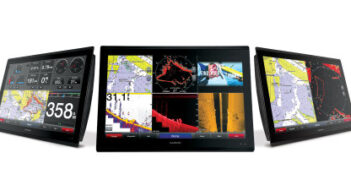
Garmin’s New Fast, Hi-Res MFDs

If you’re fitting out a new boat, or doing a major update on your existing one, take a look at Garmin’s new GPSMAP 8400 and 8600 series multifunction displays. With touchscreen control and read-in-any-light display, they have the highest screen resolution in any marine MFD, according to Garmin, and deliver the fastest map drawing ever due to a new high-performance processor. They also have full HD switching to provide accurate colors, as seen from all viewing angles. Garmin’s new MFDs come in 17-, 22- and 24-inch sizes, and start at $7,499.99. They can be networked via NMEA 2000 to…

1 2