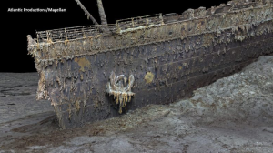
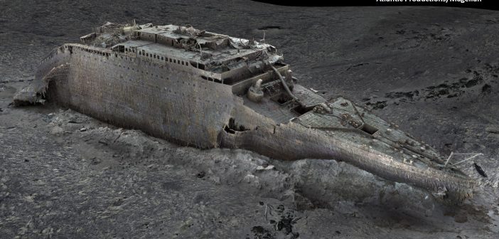
A high-tech digital-imaging project has created incredible and entirely new detailed views of the wreck of the Titanic lying 2.4 miles below the surface of the North Atlantic.
The images are the result of a six-week expedition to the wreck last summer that produced a “digital twin” of the Titanic, the largest ocean liner in the world when it sank on its maiden voyage on April 15, 1912, after it hit an iceberg. More than 1,500 people perished that night.
The expedition last summer was organized by Magellan Ltd., a deep-water mapping company. It sent two submersibles, Romeo and Juliet, down to create images of the wreck and the three-mile debris field surrounding it. As a result, Magellan gathered more than 16 terabytes of data, 715,000 still images, and a high-resolution video.
The company then spent eight months working with Atlantic Productions to create a model of “every millimeter” of the wreck and debris field. The images show an amazing amount of detail, down to the serial number on a propeller.

Atlantic Productions/Magellan
The images were able to uncover previously unknown details of what actually happened on the night the Titanic sank. One lifeboat was not able to be launched, for example, because a piece of metal was jammed in its lowering device.
They also focus on personal items scattered in the debris field, including watches and top hats, and they now are trying to match the personal items to the passengers on board using artificial intelligence. Al Geffen, the CEO of Atlantic Productions, said that in the future we may be able to witness the actual sinking using augmented reality.
“This was a challenging mission,” said Richard Parkinson, Magellan’s founder and CEO. “In the middle of the Atlantic we had to fight the elements, bad weather and technical challenges to carry out this unprecedented mapping and digitalization operation of the Titanic.” Read more at
https://www.cnn.com/videos/travel/2023/05/18/titanic-underwater-scanning-images-cprog-ac360-vpx.cnn
and see the video below:


