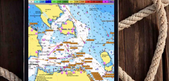
Now, with iNavX LIVE, you can get AIS data in the palm of your hand on your smartphone or tablet, without needing a transponder on your boat. The new addition to iNavX software lets you connect any mobile device to the AIS LIVE global network, so that you can see the movements of AIS vessels in real time on the iNavX display on your phone.
INavX, an app you can download from the Apple App Store or Google Play Store, has all the advantages of a mobile chartplotter that you can take on any boat, anywhere, at any time. It works on both iOS and Android devices. The ability to get real-time AIS vessel movement information on the plotter is a major addition to boating safety and situational awareness.
The app basically transforms smartphones and tablets into fully functioning, handheld chartplotters. It has all the usual nav functions – location, heading, speed, COG, waypoints and routes. Advanced features include hi-res weather overlays. You can plan and create routes remotely, on your sofa at home, for example, and then take them with you, via your phone, when you’re ready to start your next cruise. You also can set an anchor alarm, or create your log history, to see where you’ve been.
INavX is unusual in that it works with many leading chart providers, including NOAA raster charts, Navionics vector charts, Waterway Guide, Blue Latitude, Explorer Bahamas and others. It already has more than one million users around the world, working in six languages.
Shaun Steingold, the general manager of iNavX, says, “No other handheld marine chartplotter has the versatility, global capabilities and variety of features and quality charts that iNavX provides.”


