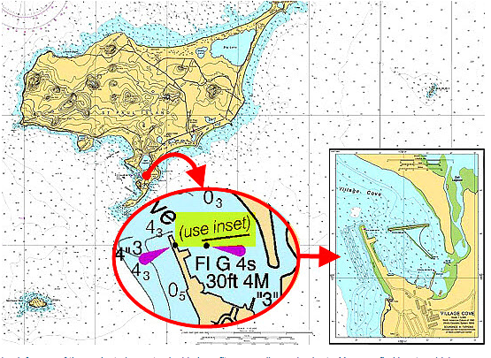
How many times on a cruise do you end up coming into a harbor or a cove or an anchorage where you’ve never been before? Probably a lot; discovering new places, embracing new adventures, is pretty much what cruising is all about.
But you need to prepare. You need to know where you’re going, particularly if you’re entering a new harbor at night, in reduced visibility, or even at the end of a day when you’re tired and not at your best. Sure, you can peer at your chartplotter and zoom in and hope for the best. That’s fine, when everything works the way it’s supposed to. But it’s certainly safer to get a blown-up view of the harbor on a paper chart so you can plot your way in long before you get there.
Here’s some great advice from Captain John’s Skipper Tips about how to do this, starting with your coastal paper chart. (Yes, there still are such things; use them.) Find the chart inset, basically a large-scale chartlet, that is inserted into the main chart page. It will give you enough detail so you can make your own waypoints inside the harbor and give you a safe route to follow. You can chart your course right on the inset, and make any notes on the chart (in a color that will not disappear under a red or blue night light) that will serve as reminders. Read more here:
https://www.skippertips.com/public/2776.cfm


