Browsing: navigation

Cruising Life
By

What Those Numbers Mean on a Chart

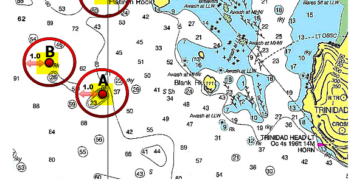
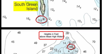
Here’s some great advice from Skipper Tips about how to read a chart – electronic or paper – showing numbers, including some with underlines or enclosed by parentheses. Here’s how to read these symbols to keep off the rocks and navigate safely: Nautical datums are stated in two ways. Look in the title block area (that area of a chart just beneath the title) to the “Chart Datum”, or soundings (depths). These will be stated as feet, fathoms, meters or a combination such as fathoms and feet or meters and decimeters (tenths of a meter). Next determine the “Height Datum.”…

Cruising Life
By

How To Use Ranges To Cruise Safely

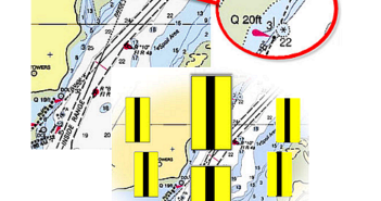
Here’s some great advice from Skipper Tips about how to use ranges to cruise safely: You enter an unfamiliar channel late in the afternoon. You scan your chart plotter or nautical chart to check for dangers to the left, or to the right. Rocky shoals lie close to the channel edges on each side. Be on the lookout for one of the sailor’s best friends – channel ranges (also called transits). These markers will lead you down the center of a narrow channel in safety, keep your sailboat in deep water, and help you navigate with confidence, day or night.…

Cruising Life
By

How To Use Contour Lines To Navigate Safely

Here’s some great advice from Skipper Tips about how to use contour lines on land to help you navigate, either when coastal cruising or when making a landfall: Think of land elevation contours like those found in water–depth contours. Cartographers will sometimes indicate the height of a contour prominent enough to be sighted by a mariner. Heights will be shown as a number, so always check the chart datum to understand the height value. It could be in feet or meters. Make this your first step so that you know at-a-glance what the height values indicate. 1. Why Stagger Contour…

Cruising Life
By

Seven Tips for Plotting Your Next Cruise

Here are seven tips from Skipper Tips about how to plot your next cruise in advance to make it safer and easier. One tip: Plot waypoints around hazards along the way. Read on: 1. Get Ready to Navigate Now! Make your piloting preparations in advance to save time and effort underway. Complete 90% of navigation plotting in the comfort of your home or apartment. Plot your base sailing courses onto each chart you will use. Highlight dangers, emergency anchorages, and prominent aids to navigation (i.e. lighted aids or those with sound signals). Plot waypoints at the start and finish of…

Cruising Life
By

NOAA Will Stop Making Paper Charts

I don’t know about you, but in a room upstairs at home I have rolled up charts that I’ve used for cruising in the Atlantic, the Pacific and the Great Lakes over the years. You may have a similar space in your home, or on your boat.  They remind me of many great (and some not-so-great) places I’ve been, miles under the belt. They’re a part of my history. Soon they may be relics. NOAA just announced that it will phase out all production of paper charts over the next five years. It will make electronic vector charts instead. NOAA…

Electronics
By

Garmin Launches New Hi-Res, Detailed Coastal and Lake Charts

Garmin just made navigation easier along the U.S. coastline and many interior lakes, expanding its coverage and improving the details and shading on its coastal and lake cartography. The new coverage, on Garmin’s BlueChart g3 Vision and LakeVü g3 Ultra premium cartography, will be shown at the Fort Lauderdale International Boat Show. The new high-resolution shading and improved detail showing the ocean floor and lake bottom cover the entire coastline of the continental United States plus 150 inland lakes. New hi-res satellite imagery overlaid on navigation charts provides a more realistic view of your surroundings and helps with situational awareness.…

Cruising Life
By

A Fast Look at AIS: How To See and Be Seen

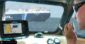
Although it’s been around on commercial vessels for many years, AIS (Automatic Identification System) is growing in popularity and use among recreational boat owners, particularly owners of cruising powerboats. It is indeed a major advance in boating safety and navigation, and a terrific tool in aiding situation awareness on board any boat. In brief, AIS is a digital, VHF-based transponder system that uses GPS, VHF radio and digital processing to communicate automatically among AIS-equipped vessels. You can integrate it on a chart plotter, radar or other display screen, put your curser on the target (another boat in the neighborhood) and…

Cruising Life
By

Magnetic North Pole Moving 31 Miles a Year. Scientists Rush To Update Charts

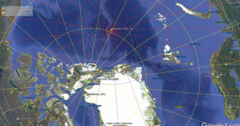
The magnetic North Pole is moving so fast that scientists are issuing an emergency update to maps used by electronic navigation systems. Magnetic north has crept from the coast of northern Canada a century ago to the middle of the Arctic Ocean now, and it’s moving at what scientists say is “an unusually high speed” of about 31 miles a year. As a result they are making an unprecedented early update of the World Magnetic Model, which fixes the pole and is responsible for the accuracy of GPS and all modern navigation on everything from nuclear submarines to your latest…

Cruising Life
By

How To Enter a New Harbor Safely Using Large-Scale Chart Insets

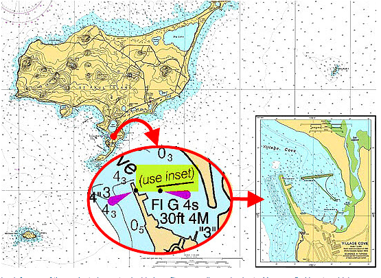
How many times on a cruise do you end up coming into a harbor or a cove or an anchorage where you’ve never been before? Probably a lot; discovering new places, embracing new adventures, is pretty much what cruising is all about. But you need to prepare. You need to know where you’re going, particularly if you’re entering a new harbor at night, in reduced visibility, or even at the end of a day when you’re tired and not at your best. Sure, you can peer at your chartplotter and zoom in and hope for the best. That’s fine, when…

Cruising Life
By

First Astrolabe, Used to Navigate in 1500, Found in Vasco da Gama Shipwreck

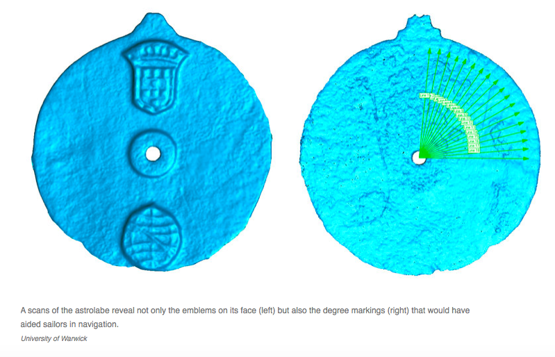
If you think navigating was difficult in the days before GPS, take a look at this. It’s the world’s first astrolabe, a bronze disc that Vasco da Gama’s navigators used to sail from Portugal to India around 1500, just a few years after Columbus found America. In 1503, da Gama was returning home after his second voyage to India. He left several ships behind to explore (and exploit) the area, but they sank in storms. Several years ago, researchers found this 7-inch astrolabe among many artifacts on one of those ships, Esmeralda, off the coast of Oman. At first, they…